
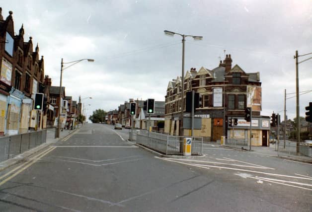


When you walked around Harehills in the early 1980s the vast majority of shops were boarded up for protection as a result of riots in the area. The riots, which sprung up in neighbouring Chapeltown, followed on from riots in other parts of the country such as Brixton and Toxteth, and were primarily racially motivated, though other factors such as social deprivation, poor housing and high unemployment also caused a lot of tension. These photos showcase a community on edge as well as others featuring lost landmarks and a bird’s eye view. They are published courtesy of photographic archive Leodis, which is run by Leeds Library & Information Service. They also run heritage blog The Secret Library Leeds, which provides a behind the scenes look at the Central Library and highlights from its special collections, including rare books hidden away in the stacks. READ MORE: 43 closed Leeds pubs which will stir fond memories for drinkers LOVE LEEDS? LOVE NOSTALGIA? Join Leeds Retro on facebook YEP NEWSLETTERS: Sign up for free news and sport emails
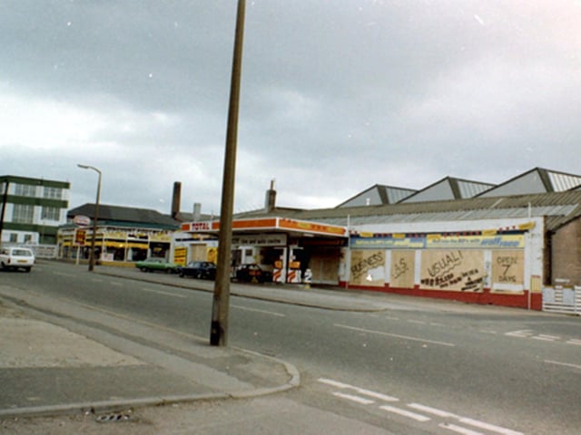
7. Harehills in the 1980s
Harehills Lane showing Troy Garage, boarded up for protection as a result of riots in the area, but proclaiming Business As Usual. Photo: Leeds Libraries, www.leodis.net
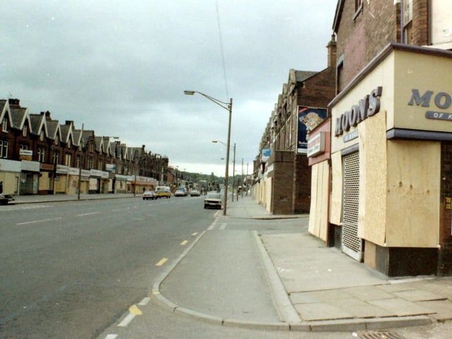
8. Harehills in the 1980s
Shops seen here on Roundhay Road include Moons fancy goodson the right, with Lambton View in the foreground and Lambton Grove behind. Photo: Leeds Libraries, www.leodis.net
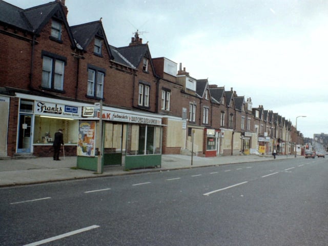
9. Harehills in the 1980s
Harehills Lane showing a parade of shops between Berkeley Road and Strathmore Drive. Photo: Leeds Libraries, www.leodis.net
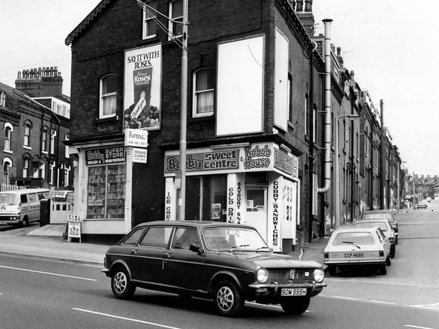
10. Harehills in the 1980s
Bobby Superstore on Roundhay Road in April 1980. Next door is Bobby Sweet Centre and Kebab House offering ice cream, cold drinks, savoury snacks, curry and sandwiches. Homes in Bayswater Terrace can be seen left and Bayswater Row is on the right. Photo: Leeds Libraries, www.leodis.net
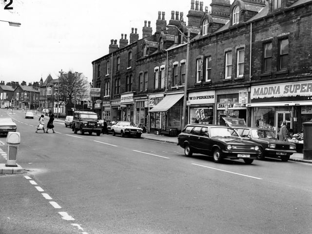
11. Harehills in the 1980s
A parade of shops in Roundhay Road looking towards the junction with Roseville Road. Pictured in April 1980. Photo: Leeds Libraries, www.leodis.net
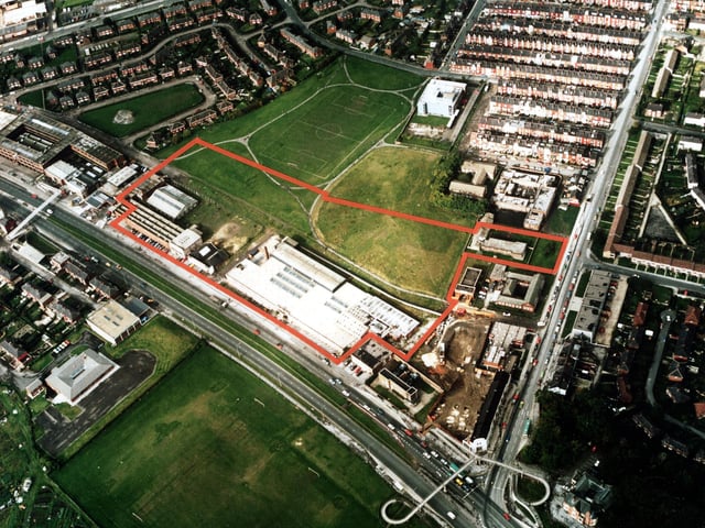
12. Harehills in the 1980s
A colour aerial view showing York Road, with Harehills Lane on the right. Factories and warehouses are in the centre. In the top left is semi-detached housing of Torre Hill and Torre Crescent, and top right terraced housing of the Nowells; the white building next to these is a telephone exchange. Victoria County Primary School is at the bottom left, with the Shaftesbury public house bottom right. Several playing fields are in view including a football pitch. Pictured in March 1985. Photo: Leeds Libraries, www.leodis.net