
Storm Floris weather warnings: Met Office shares advice on staying safe in a storm as wind warnings in place

Watch the latest Met Office video forecast, as the forecaster shares advice on how to stay safe in a storm.
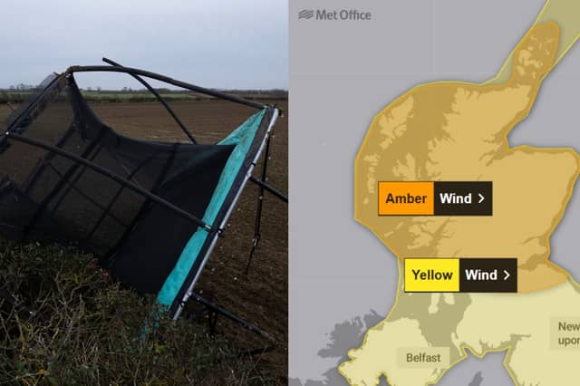
The Met Office has shared advice on how to stay safe in a storm, as amber and yellow wind warnings are in place.
Met Office amber wind warning
The Met Office amber wind warning will be in place until 23:00 on August 4, covering Central, Tayside and Fife, Grampian, the Orkney Islands, SW Scotland, Lothian Borders and Strathclyde.
The warning reads: “Storm Floris will bring unseasonably strong and disruptive winds to much of Scotland during Monday.
“Injuries and danger to life from large waves and beach material being thrown onto sea fronts, coastal roads and properties. Some damage to trees and buildings, such as tiles blown from roofs, expected. Longer journey times and cancellations, as road, rail, air and ferry services affected. Some roads and bridges closed. Flying debris could lead to Injuries or danger to life. Power cuts with the potential to affect other services, such as mobile phone coverage.
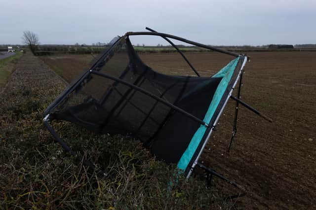
“Storm Floris will bring a spell of unusually strong west or northwesterly winds to much of Scotland during Monday. Gusts of 50 to 70 mph are expected for many parts, and are likely to reach 80 to 90 mph on some exposed coasts, hills and bridges. Western coastal areas will see the highest gusts between late morning and early afternoon, the strongest winds then transferring to northeastern Scotland by late afternoon/early evening.”
Met Office yellow wind warning
A yellow wind warning from the forecaster will be in place for Central, Tayside and Fife, Grampian, Highlands and Eilean Siar, North East England, North West England, Northern Ireland, Orkney and Shetland, SW Scotland, Lothian Borders, Strathclyde, north Wales and Yorkshire and Humber until 23:59 on August 4.
The warning reads: “Storm Floris is likely to bring a spell of unseasonably strong and potentially disruptive winds to northern UK on Monday.
“Some damage to buildings, such as tiles blown from roofs, could happen. Injuries and danger to life from flying debris are possible. Power cuts may occur, with the potential to affect other services, such as mobile phone coverage. Injuries and danger to life could occur from large waves and beach material being thrown onto sea fronts, coastal roads and properties. Some roads and bridges may close. Road, rail, air and ferry services may be affected, with longer journey times and cancellations possible.
“Storm Floris will bring a spell of unusually windy weather for the time of year across the northern half of the UK on Monday. The highest winds are expected across Scotland between late morning and early evening. In some areas high winds will be accompanied by heavy rain. Wind will then slowly start to ease from the west later. Across the warning area, many inland areas are likely to see gusts of 40 to 50 mph with 60 to 70 mph possible along exposed coasts and high ground, especially Scotland. During the height of the storm, winds over parts of Scotland will be even higher and this is covered by a separate amber warning.”
Met Office further yellow wind warning
The Met Office has issued a yellow wind warning for the Orkney and Shetland Islands from 00:00 to 08:00 on August 5.
The warning reads: “High winds as Storm Floris clears may bring disruption to travel.
“Some delays to road, air and ferry transport are likely. It’s likely that some coastal routes, sea fronts and coastal communities will be affected by spray and/or large waves. Probably some bus and train services affected, with some journeys taking longer. Some short term loss of power and other services is possible. Delays for high-sided vehicles on exposed routes likely.
“Very strong northwesterly winds, including gusts of 50 to 70 mph, in the wake of Storm Floris will ease across Orkney early on Tuesday and then slowly wane a little over Shetland during Tuesday morning.”
How to stay safe in a storm
Before the storm
- Secure loose objects such as ladders, garden furniture or anything else that could be blown into windows and other glazing and break them
- Close and securely fasten doors and windows, particularly those on the windward side of the house, and especially large doors such as those on garages
- Park vehicles in a garage, if available; otherwise keep them clear of buildings, trees, walls and fences
- Close and secure loft trapdoors with bolts, particularly if roof pitch is less than 30°
- If the house is fitted with storm shutters over the windows then ensure that these are closed and fastened
- If chimney stacks are tall and in poor condition, move beds away from areas directly below them
During the storm
- Stay indoors as much as possible
- If you do go out, try not to walk or shelter close to buildings and trees
- Keep away from the sheltered side of boundary walls and fences - if these structures fail, they will collapse on this side
- Do not go outside to repair damage while the storm is in progress
- If possible, enter and leave your house through doors in the sheltered side, closing them behind you
- Open internal doors only as needed, and close them behind you
- Take care when driving on exposed routes such as bridges, or high open roads, delay your journey or find alternative routes if possible
- Slow down and be aware of side winds, particular care should be taken if you are towing or are a high sided vehicle
- Do not drive unless your journey is really necessary
After the storm
- Be careful not to touch any electrical/telephone cables that have been blown down or are still hanging
- Do not walk too close to walls, buildings and trees as they could have been weakened
- Make sure that any vulnerable neighbours or relatives are safe and help them make arrangements for any repairs