
UK weather: Leeds snow and ice warning issued by Met office as travel disruption expected
Watch the Met Office video forecast, as a snow and ice warning is issued for Leeds.
The Met Office has issued a snow and ice warning for Leeds, with disruption to travel expected.
The yellow snow and ice warning will be in place from 00:00 to 11:00 on Tuesday January 6.
The warning reads: “Snow and ice may cause some disruption on Tuesday morning, particularly to travel.
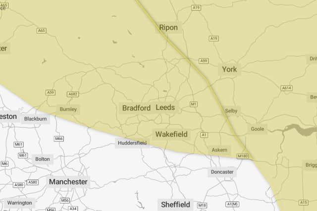

“Some roads and railways likely to be affected with longer journey times by road, bus and train services. Some injuries from slips and falls on icy surfaces. Probably some icy patches on some untreated roads, pavements and cycle paths.
“An area of mainly light snow will move east across southern Scotland into northern England on Tuesday morning before largely fading and clearing during Tuesday afternoon. A few heavier bursts are possible over the Southern Uplands, the Lake District and the northern Pennines.
“Most places will see no more than 1-2 cm of snow but a few places over higher ground in the Lake District, northern Pennines and Southern Uplands may see up to 5 cm. This will fall onto frozen surfaces resulting in some icy conditions and could lead to some disruption, particularly to travel over higher routes in the north of the warning area.”
Today (Monday January 5 2026)
Snow showers pushing inland from the North Sea at first, before becoming confined to coasts later. Rather cloudy to start, sunny spells developing later in the afternoon. Winds slowly easing. Cold. Maximum temperature 1 °C.
Tonight (Monday January 5 2026)
Any coastal showers soon clearing this evening. Becoming clear and very cold overnight with a hard frost and icy stretches. A light breeze throughout. Minimum temperature -9 °C.
Tuesday (January 6 2026)
Increasingly cloudy through Tuesday, with a mixture of some rain, sleet and snow. Less cold than previous days but winds becoming strong later in the day. Maximum temperature 4 °C.
Outlook for Wednesday to Friday (January 7 2026 to January 9 2026)
Dry, windy but sunny Wednesday, with coastal showers. Rain, sleet and snow Wednesday night, clearing to sunny spells and light winds Thursday. Increasingly windy, with a risk of snow Friday.