
Leeds snow: Hour-by-hour forecast as snowfall on the way and yellow warning in place

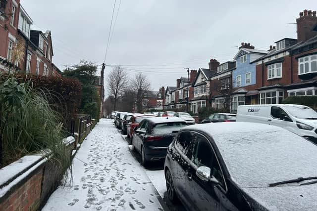
The cold weather is set to grip Leeds once again this week, with yellow weather warnings in place and talk of snow returning to the city.
Forecasters at the Met Office have issued an official yellow warning for snow and ice, which comes into force at 7pm on Thursday and is expected to remain in place through much of Friday.
While the city has faced a relentless period of rain, this incoming Arctic air marks a sharp shift toward hazardous winter conditions.
According to the latest local forecast, the most significant risk for the city centre will arrive on Friday afternoon, with temperatures set to plummet to 1C, though a biting northerly wind will make it feel significantly colder at -3C.
However, the primary concern for many will be the flash freeze forecast to follow immediately after the snow showers clear.
As the sun sets, any wet or slushy surfaces are expected to turn to sheet ice overnight as temperatures drop to a low of -2C, leading the Met Office to warn of a high risk of slips and falls on untreated pavements.
Residents are being urged to plan their journeys, with the snow window likely to cause significant delays on the M1, M62, and local bus networks.
While higher ground around Cookridge and Guiseley is expected to see the most accumulation, the timing of the snowfall in the city centre means that even light flurries could lead to a difficult start to the weekend for many.
When is it forecast to snow in Leeds this week?


According to the latest Met Office data for Leeds, the city is set for a prolonged period of wintry conditions with several specific windows for snowfall and sleet.
The first spell of winter weather is expected to arrive late on Thursday night, with sleet showers forecast to begin at 8pm. These wintry showers are predicted to continue through the night, eventually transitioning into light snow during the early hours of Friday morning, specifically between 4am and 6am.
Following a cloudy and cold morning, a second wave of wintry weather is forecast for Friday afternoon. Sleet showers are expected to return at 3pm and 4pm, just as the city prepares for the school run and the start of the weekend commute.
The wintry conditions are set to return after a clear and freezing Saturday. A fresh band of sleet is forecast for Sunday morning, beginning at 3am and potentially lasting until midday before turning to rain as temperatures slowly rise.
Leeds weather - hour-by-hour forecast for January 12-January 15
Thursday
- 12am: Light rain (6°)
- 1am: Light rain (6°)
- 2am: Light rain (6°)
- 3am: Light rain (5°)
- 4am: Overcast (5°)
- 5am: Overcast (5°)
- 6am: Overcast (5°)
- 7am: Overcast (4°)
- 8am: Overcast (4°)
- 9am: Overcast (4°)
- 10am: Overcast (5°)
- 11am: Overcast (5°)
- 12pm: Overcast (5°)
- 1pm: Overcast (5°)
- 2pm: Light rain (5°)
- 3pm: Light rain (5°)
- 4pm: Light rain (4°)
- 5pm: Light rain (4°)
- 6pm: Light rain (4°)
- 7pm: Light rain (3°)
- 8pm: Sleet shower (3°)
- 9pm: Light rain (3°)
- 10pm: Sleet shower (3°)
- 11pm: Sleet shower (2°)
Friday
- 12am: Sleet shower (2°)
- 1am: Sleet shower (2°)
- 2am: Sleet shower (2°)
- 3am: Sleet shower (2°)
- 4am: Light snow (2°)
- 5am: Light snow (2°)
- 6am: Cloudy (2°)
- 7am: Cloudy (2°)
- 8am: Cloudy (1°)
- 9am: Cloudy (2°)
- 10am: Cloudy (2°)
- 11am: Cloudy (3°)
- 12pm: Cloudy (3°)
- 1pm: Cloudy (4°)
- 2pm: Cloudy (4°)
- 3pm: Sleet shower (3°)
- 4pm: Sleet shower (3°)
- 5pm: Partly cloudy (2°)
- 6pm: Partly cloudy (2°)
- 7pm: Partly cloudy (2°)
- 8pm: Partly cloudy (1°)
- 9pm: Partly cloudy (1°)
- 10pm: Partly cloudy (1°)
- 11pm: Clear night (1°)
Saturday
- 12am: Clear (0°)
- 1am: Clear (0°)
- 2am: Clear (0°)
- 3am: Clear (0°)
- 4am: Clear (0°)
- 5am: Clear (0°)
- 6am: Clear (0°)
- 7am: Clear (-1°)
- 8am: Sunny (0°)
- 9am: Sunny (0°)
- 10am: Sunny (2°)
- 11am: Sunny (3°)
- 12pm: Sunny (4°)
- 1pm: Sunny (5°)
- 2pm: Sunny (5°)
- 3pm: Sunny (5°)
- 4pm: Sunny (5°)
- 5pm: Clear night (4°)
- 6pm: Partly cloudy (3°)
- 7pm: Cloudy (3°)
- 8pm: Cloudy (2°)
- 9pm: Cloudy (2°)
- 10pm: Cloudy (2°)
- 11pm: Cloudy (2°)
Sunday
- 12am: Cloudy (2°)
- 1am: Cloudy (2°)
- 2am: Cloudy (2°)
- 3am: Sleet shower (2°)
- 4am: Sleet shower (2°)
- 5am: Sleet shower (2°)
- 6am: Sleet shower (2°)
- 7am: Sleet shower (2°)
- 8am: Sleet shower (2°)
- 9am: Sleet shower (3°)
- 10am: Sleet shower (3°)
- 11am: Light rain (4°)
- 12pm: Light rain (5°)
- 1pm: Light rain (6°)
- 2pm: Light rain (6°)
- 3pm: Light rain (6°)
- 4pm: Light rain (6°)
- 5pm: Light rain (6°)
- 6pm: Light rain (6°)
- 7pm: Light shower (6°)
- 8pm: Light shower (6°)
- 9pm: Light shower (6°)
- 10pm: Light shower (6°)
- 11pm: Light shower (6°)
Have you spotted snowfall earlier in your neck of the woods? Send in your images when the snow begins to fall in the city by emailing our news desk.