

The gallery of memories brings into focus properties which were under the threat of the bulldozer as the suburb braced itself for change. The photos turn back the clock to 1966 at a time plans were revealed to demolish large parts of the community. They provide a fascinating insight into life around LS12 which is sure to evoke memories for a generation of residents. The images are published courtesy of West Yorkshire Archive Service, which collects and looks after the unique documentary heritage of the region dating from the 12th century to the present day - more than 800 years of local history. It also runs Catablogue, an online blog dedicated to preserving the past, serving the present and protecting the future. READ MORE: Memories of lost Leeds pubs in Armley, Wortley and Farnley LOVE LEEDS? LOVE NOSTALGIA? Join Leeds Retro on facebook YEP RETRO NEWSLETTER: Sign up for our free monthly email digest of Leeds nostalgia
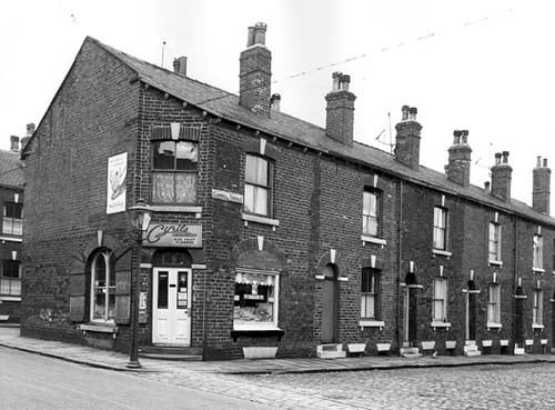
1. Armley in 1966
On the left of this view is Cyril's greengrocery, which also sells fish, fruit and flowers. This was number 10 Main Road. Cardwell Street runs to the right edge, numbers 3 to 9 are in view. These houses awaited demolition in line with the citywide slum clearance programme. | West Yorkshire Archive Service Photo: West Yorkshire Archive Service
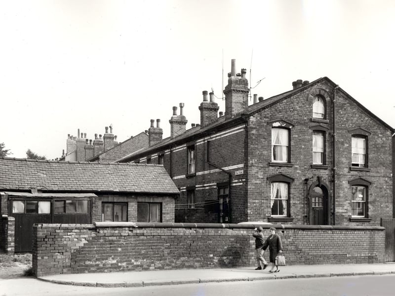
2. Armley in 1966
On the left edge of this view is a garage which belonged to number 228 Tong Road, the large gable end property on the right edge. Fox View ran between these two buildings. Included in slum clearance plans for the Armley area. Pictured in September 1966 | West Yorkshire Archive Service Photo: West Yorkshire Archive Service
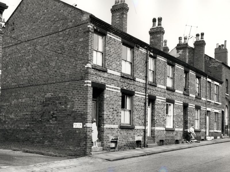
3. Armley in 1966
On the left edge of this view is a gap in the terrace which gave access to Fox View. Back-to-back properties on Main Road run to the right in ascending order from number 11 on the left where a woman stands on the doorstep. Photo taken prior to slum clearance. Pictured in September 1966. | West Yorkshire Archive Service Photo: West Yorkshire Archive Service
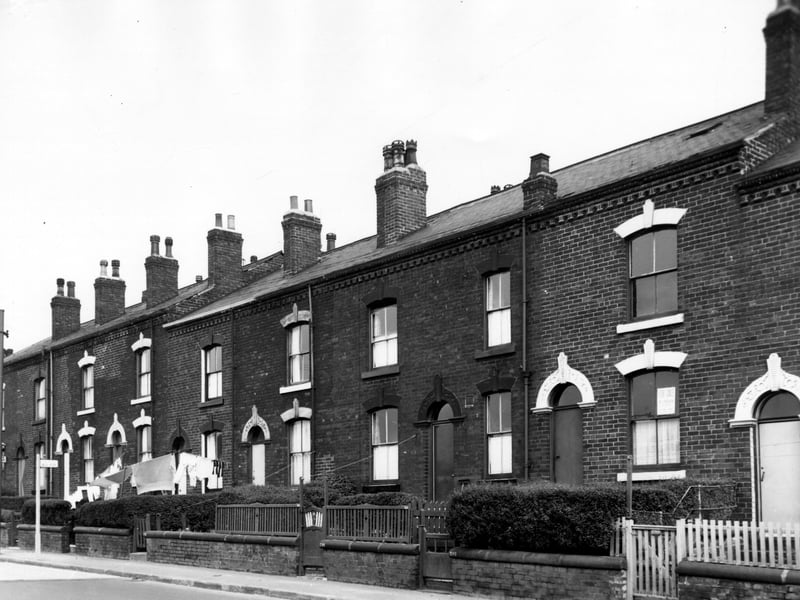
4. Armley in 1966
Properties on Tong Road, numbers run from the left in descending order to number 212 on the right with the doorway of number 210 on the right edge. The majority of these houses went through to Cardwell Street apart from number 214 which was a blind back, the resulting gap in the terrace was occupied by an outside toilet block. Included in slum clearance plans for the area.. | West Yorkshire Archive Service Photo: West Yorkshire Archive Service
5. Armley in 1966
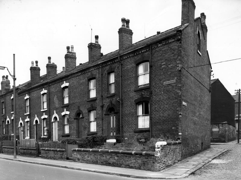
Through houses on Tong Road run from the left edge of this view in descending order to number 202 on the right. These properties on Tong Road (numbers 202 to 226) had at one time been known as Clifton Terrace with carved stones at either end of the block bearing this name. Houses had back entrances on Cardwell Street. Main Street can be seen on the right edge. Included in slum clearance plans. | West Yorkshire Archive Service Photo: West Yorkshire Archive Service
6. Armley in 1966
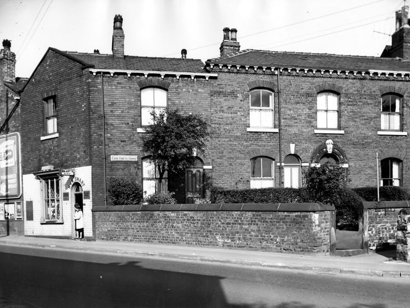
On the left of the image is number 232 Tong Road, the H & N Smart florist, offering wedding bouquets and cremation sprays and wreaths. On the far left can be seen a large advertising hoarding promoting bread. On the right are numbers 1 and 1a Carr Crofts Grove a row of back-to-back terraced houses each with a private garden. | West Yorkshire Archive Service Photo: West Yorkshire Archive Service