

Pubs, shops, factories and landmarks are all featured in this collection of memories from a decade of change and challenges. The images are published courtesy of West Yorkshire Archive Service, which collects and looks after the unique documentary heritage of the region dating from the 12th century to the present day - more than 800 years of local history. It also runs Catablogue, an online blog dedicated to preserving the past, serving the present and protecting the future. READ MORE: 18 lively photos take you back to Lincoln Green in the early 2000s LOVE LEEDS? LOVE NOSTALGIA? Join Leeds Retro on facebook YEP RETRO NEWSLETTER: Sign up for our free monthly email digest of Leeds nostalgia
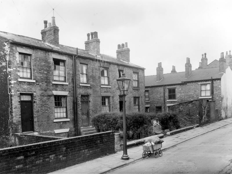
1. Lincoln Green in the 1950s
Three brick built terraced houses on Haymount Street in an area of Newtown designated for clearance. An ancient pram almost buckles under the weight of bundles of chips obviously being sold around the streets for fire lighters. this area is now part of the Lincoln Green estate. Pictured in October 1958. | Leeds Libraries, www.leodis.net Photo: Leeds Libraries, www.leodis.net
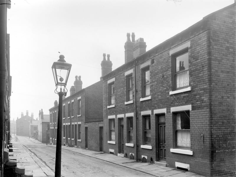
2. Lincoln Green in the 1950s
Haymount Street looking towards Lincoln Field Row in August 1958. The two main blocks of back to back terraced houses in this photo are separated by a yard where the outside toilets are located. This was part of Newtown locality, now redeveloped as Lincoln Green. | West Yorkshire Archive Service Photo: West Yorkshire Archive Service
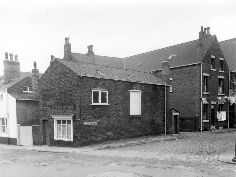
3. Lincoln Green in the 1950s
Part of the Newtown area, showing number 1a Lincoln Road at the junction with Moorehouse Place in August 1958. This building has been the premises for various businesses, a joiners in 1899, an upholsterers in 1923, a boot repairer and wireless engineer in 1940 and a biscuit manufacturer in 1947, C Percy Liversidge. Far left, part of the rear of the 'Moulders Arms' is visible. | West Yorkshire Archive Service Photo: West Yorkshire Archive Service
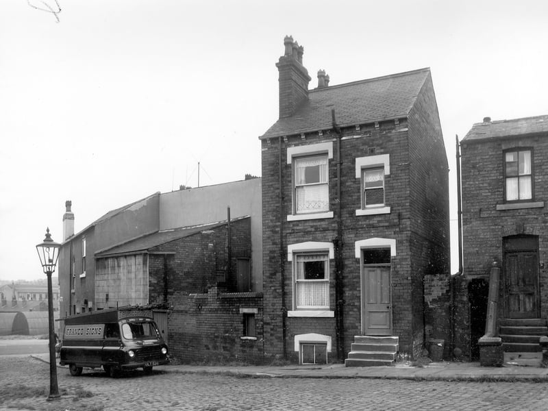
4. Lincoln Green in the 1950s
Lincoln Field Terrace in the Newtown locality in August 1958. Dolly Lane can be seen far left. This area was cleared and is now part of the site of Primrose High School. Number 1A is the detached brick house in the centre with number 3 to the right of it. A van owned by 'Franco Signs' is parked in the street, their business was at 170 Meanwood Road. | Leeds Libraries, www.leodis.net Photo: Leeds Libraries, www.leodis.net
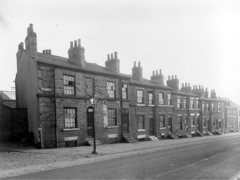
5. Lincoln Green in the 1950s
Long view of Dolly Lane looking towards Cherry Row in October 1958. The junction with Primrose Place can be seen far left. The first of the back to back brick built terraced houses on the left is number 24 and numbers descend right in an even sequence. This locality of Newtown was scheduled for demolition and is now part of the Lincoln Green estate. An LCT (Leeds City Transport) bus stop is attached to the street lamp on the corner. | West Yorkshire Archive Service Photo: West Yorkshire Archive Service
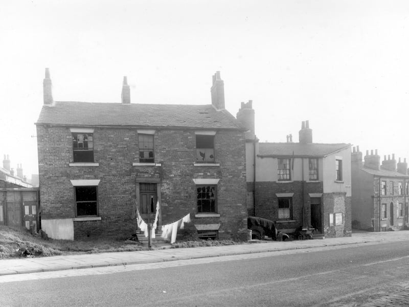
6. Lincoln Green in the 1950s
Derelict property on Dolly Lane in the Newtown locality in October 1958.. This area was scheduled for demolition at the time this photograph was taken and is now part of the Lincoln Green estate. The main house in the photograph is unnumbered on the City Engineers map but to the right is number 28 Dolly Lane and a pram is parked outside . It may be the occupants of this house who have taken the opportunity to hang out the family washing in front of the derelict house. | West Yorkshire Archive Service Photo: West Yorkshire Archive Service