
Leeds ice warning issued and potential ‘multi-hazard event’ explained - when warning will be in place
Watch the Met Office video forecast, as an ice warning is issued for Leeds and West Yorkshire.
The Met Office has issued an ice warning for Leeds and West Yorkshire.
The yellow ice warning will be in place from 00:00 to 10:00 on Wednesday January 7.
The warning reads: “Icy patches overnight Tuesday into Wednesday morning could lead to some disruption.
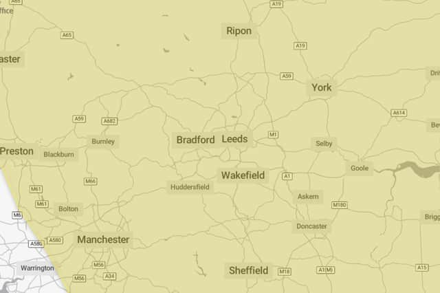

“Some injuries from slips and falls on icy surfaces. Probably some icy patches on some untreated roads, pavements and cycle paths.
“Following a band of precipitation which clears southeast overnight, clear skies will develop for many areas on Tuesday night will lead to icy patches on untreated wet surfaces. This could lead to some minor disruption especially on Wednesday morning.”
Met Office on potential for ‘multi-hazard event’
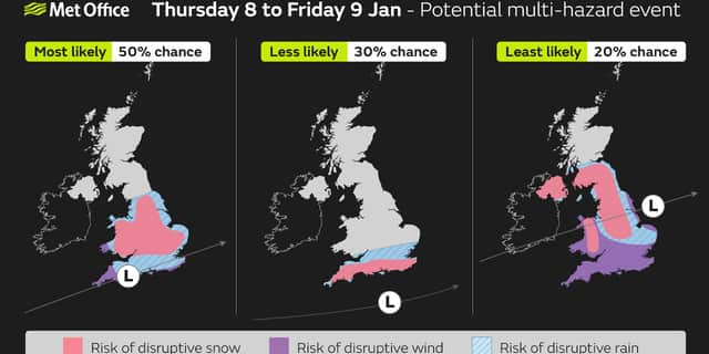
The Met Office say that further into the week there are signs that strong winds and heavy rain may bring additional hazards to the impactful weather across the UK.
Mike Silverstone, Deputy Chief Meteorologist, said: “While we’re confident an area of low pressure will move in from the west on Thursday and into Friday, the exact position of that low pressure is uncertain at this stage. The position is important as it will determine the type of severe weather different locations may experience.
“The most likely scenario at this stage is for low pressure to track near the south coast. Near and south of the low, heavy rain and strong winds are more likely, whilst snow could accumulate to the north as it encounters cold air. As confidence increases in the track of the low pressure, so will the detail of the weather impacts so it is important to stay up to date with the weather forecast through the week.”
Met Office Yorkshire and Humber weather forecast
Today (Tuesday January 6)
Cloudy through the day, with outbreaks of patchy rain and sleet, with some snow over high ground. Becoming heavier and more organised later in the afternoon. Less cold than previous days but winds increasing later in the day. Maximum temperature 4 °C.
Tonight (Tuesday January 6)
Organised bands of rain and sleet, with further snow over high ground through the evening, gradually clearing overnight. Strong winds throughout. Cold and frosty with icy stretches. Minimum temperature -2 °C.
Wednesday (January 7)
Dry, windy but bright with sunny spells and patchy cloud on Wednesday. Increasingly cloudy with outbreaks of rain, sleet and snow overnight. Cold. Maximum temperature 3 °C.
Outlook for Thursday (January 8) to Saturday (January 10)
Early, rain, sleet and snow clearing east Thursday to brighter conditions. Becoming windy with a chance of heavy snow overnight into Friday, low confidence. Sunny, with light winds probable Saturday.